


Disaster Alert

Disaster Alert介绍
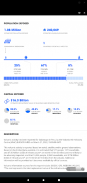
Disaster Alert 是一款供公众使用的免费移动应用程序,可为全球社区提供重要的危险警报和在世界任何地方保持安全所需的信息。 Disaster Alert™️ 建立在 PDC 的 DisasterAWARE®️ 平台之上,提供有关 18 种不同类型的自然灾害在全球范围内发生的近乎实时的更新。
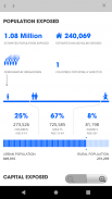
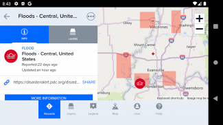
借助 Disaster Alert,您可以自定义预警警报、查看估计的影响报告以及访问可视化的建模灾害数据。灾难警报源源不断的新信息是从最可靠、经过科学验证的来源自动生成的。当没有可用的官方来源时,警报由太平洋灾难中心手动更新,在事件发生时间和系统信息可用性之间仅显示一小段时间。
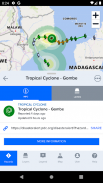
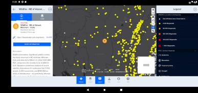
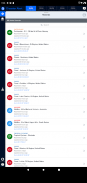
灾难警报提供的危险更新仅包括活动危险。 “活动危险”是最近发生的一系列事件的一部分,这些事件已被 PDC 指定为对人员、财产或资产具有潜在危害。
包括的危险类型
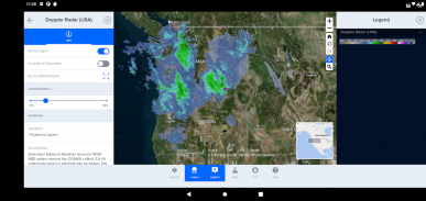
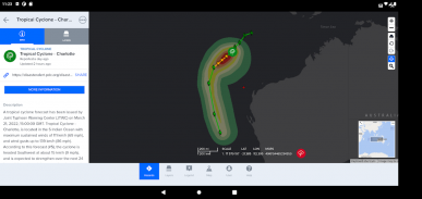
*近乎实时地自动处理:飓风(热带气旋/台风)、地震、海啸、火山、洪水、野火、美国龙卷风和冬季风暴。
*人工处理:海洋灾害、风暴、干旱和人为事件。仅夏威夷提供高强度冲浪警告、大风和山洪。
版本 7.5.4 中的新功能
*默认主题:PDC主题已被应用为灾难警报中的默认主题。 PDC 主题集成了 DisasterAWARE 品牌、颜色和图标。可以从用户首选项菜单应用不同的主题。
*多语言登录和注册:灾难警报用户将能够使用英语以外的多种支持语言登录和注册。表单顶部有一个下拉选择器,允许用户更改语言选项。
*入职:我们引入了新的首次用户应用程序设置功能灾难警报,以允许自定义警报位置和危险严重程度。从先前版本更新到 7.5.4 以及新安装时,所有用户都会看到此屏幕。用户将可以选择签署操作、登录或以访客身份直接跳到灾难警报而无需帐户。警报首选项只能由注册用户自定义。
*用户注册电子邮件:灾难警报现在支持额外的注册电子邮件格式,用于新用户注册表的附加地址(又名子地址)电子邮件格式。
其他主要特点
*可根据您感兴趣的地理区域和危险严重程度定制警报
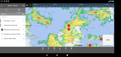
*当通过在地图上选择危险来激活地图提示时,用户可以通过选择“更多信息”链接并查看危险简介来获得估计的影响信息。
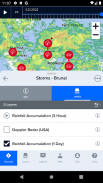
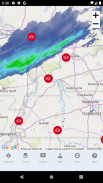
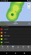
* 交互式地图界面显示 18 种不同类型的活动危险
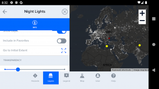
*可定制的背景地图
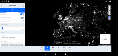
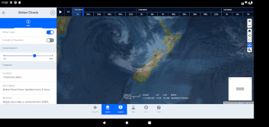
*地图图层覆盖人口密度、全球云层覆盖等。
Disaster Alert - 版本533.782.201
(28-03-2025)
Disaster Alert - APK信息
APK版本: 533.782.201程序包: disasterAlert.PDCDisaster Alert的最新版本
其他版本


同类应用

您可能还会喜欢……


